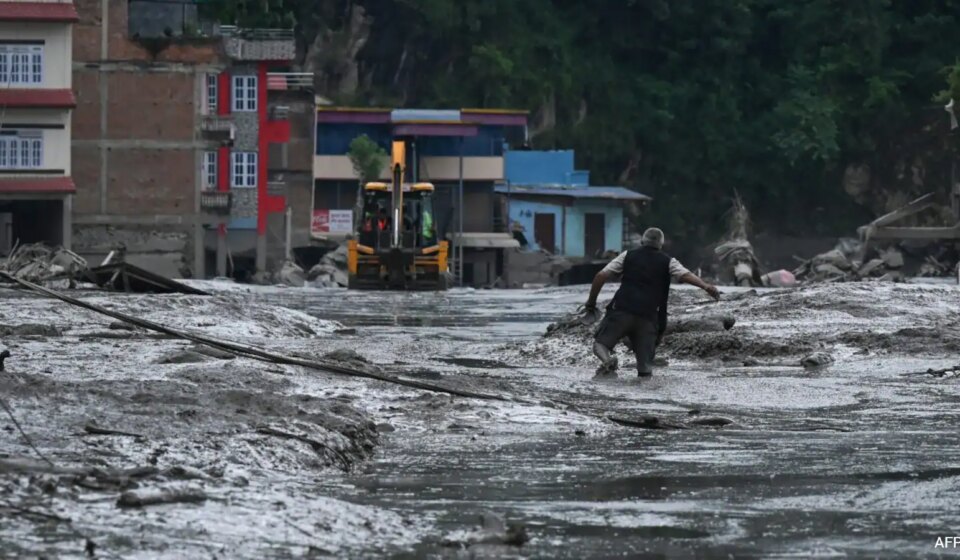

At least 160 people have died and hundreds remain missing after a sudden landslide and cascading flood struck the Nepal–Tibet border on Wednesday morning, engulfing buildings and sweeping away buses and cars, according to footage from the Chinese side that shows a wall of mud and debris overrunning several-storey structures. The exact cause is still under investigation, but authorities and scientists say a landslide that blocked a river and then released a large volume of water is the most likely scenario.
Nepal’s Foreign Minister Shishir Khanal said an earthquake likely triggered the initial landslide that dammed the river and sent water rushing downstream when the obstruction failed. The US Geological Survey, however, said additional analysis showed the seismic energy recorded was generated by a landslide rather than a conventional earthquake. The Kathmandu-based International Centre for Integrated Mountain Development (ICIMOD) reported a preliminary assessment found “no anomalies” on the Chinese side of the border.
Sarthak Shrestha, a remote sensing and geoinformation analyst at ICIMOD, told AFP: “We believe a rock-ice avalanche occurred in Nepal, blocking the Lhende river and causing the cascading flood event.” ICIMOD’s Qianggong Zhang warned the risk of a second flood remains because of an ongoing blockage upstream.
Experts stress that these fast-moving flows of mud and water are extremely hard to predict. Hatim Sharif, a hydrologist at the University of Texas San Antonio, said one striking detail was the lack of rainfall before the event, adding this can render standard flood warning systems ineffective. He warned that by the time people see a mud flow it is often too late: “Running will not help,” and fleeing by vehicle can be futile because the mixture travels at high speed and behaves “like liquid concrete.” Sharif said the only immediate survival option is to climb to higher ground — at least 20 feet (six metres) above the flood path — and suggested river-level gauges that relay real-time changes could give communities 20–30 minutes’ warning in future.
Researchers note the Himalayas’ steep topography and narrow river valleys amplify the danger when avalanches or landslides block channels, creating sudden, powerful floods. Dorothy Heinrich of the University of Reading said such blockages cause “a big accumulation of water” that then produces “incredibly fast floods.”
While it is too soon to draw firm links to climate change, scientists say long-term trends in the region — including heat waves, glacial retreat and permafrost loss — increase the likelihood of landslides and glacial lake outburst floods (GLOFs). A notable GLOF in July 2025 originated in China’s Gyirong County and surged into Nepal’s Rasuwa District, illustrating the cross-border nature of such hazards. In the coming days and weeks, researchers plan attribution studies to assess how climate change may have altered the odds of this disaster.
Original Source: https://www.ndtv.com/world-news/what-scientists-know-so-far-about-nepals-deadly-floods-11964019#publisher=newsstand
Category:
Tags:
Publish Date: 2026-08-27 04:13:00