
IIT Guwahati hydrologist Arup Kumar Sarma has warned that development in the hill states surrounding Assam — if carried out without detailed hydrological studies and ecological safeguards — can significantly worsen downstream flooding during high‑intensity rainfall. Speaking on floods that recently affected upper Assam and the Khanapara‑Jorabat area of Guwahati, Sarma said roads, mining and other infrastructure projects in Arunachal Pradesh, Nagaland and Meghalaya can change water and sediment flows and raise flood risk in the plains.
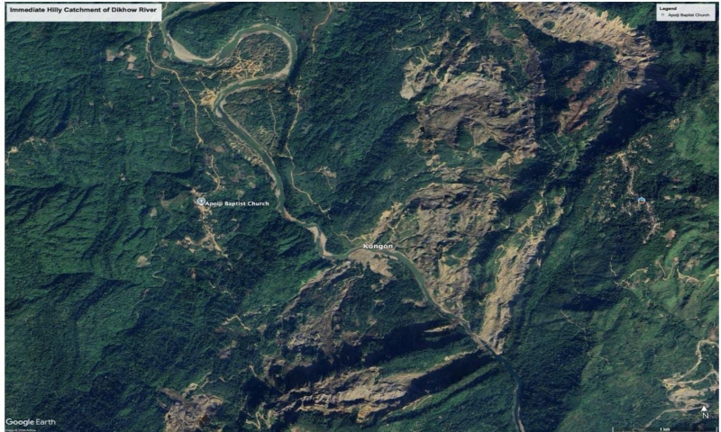
Sarma pointed to two main drivers behind the atypical flood pattern. The first is extensive deforestation in immediate upper catchments, visible on satellite imagery for upstream hills in Nagaland (impacting Sibsagar and Jorhat), Arunachal Pradesh (affecting Dhemaji and Dibrugarh) and Meghalaya (affecting Khanapara, Jorabat and Guwahati). He said such vegetation loss — often linked to boulder mining, road construction and other works — increases water and sediment yield, causing rivers to become shallower and lose carrying capacity.
The second factor, Sarma said, is changing rainfall patterns linked to climate change. He noted that high‑intensity precipitation events, amplified this year by El Niño influences and cyclonic moisture movement from the Bay of Bengal, can produce heavy orographic rainfall over saturated, deforested slopes, generating very large runoff. “High intensity rainfall over saturated deforested land generates very high water yield,” he said.
Poorly designed road crossings also exacerbate problems, Sarma added. “Inadequate openings kept for the hilly streams in road crossings can lead to flooding and landslides,” he said, warning that blocked channels on plains can cause upstream stagnation and flash flooding.
Sarma cautioned that other hill‑plain districts such as Karbi Anglong and Dima Hasao could face similar risks under comparable precipitation. He highlighted the Kapili reservoir as an example where upstream storage may force dam authorities to release excess water once capacity is exceeded, underlining the need for continuous reservoir monitoring and timely warnings.
To reduce flood risk, Sarma urged coordinated disaster preparedness across hill and plains states. He proposed a joint committee including academicians, reservoir authorities and district officials, and recommended hydrodynamic and hydrological modelling with sensor‑based inputs to improve forecasting and early warning. He also called for more rain gauges in hilly terrain, community awareness and crowdsourced data, and regular drone monitoring to spot critical situations.
On recovery and prevention, Sarma advocated immediate ecological restoration of degraded catchments through Ecological Management Practices (EMPs). “Immediate steps should be taken collectively for reforestation of the degraded catchment,” he said, recommending economically beneficial, erosion‑controlling plant varieties alongside structural measures such as retaining walls, water‑harvesting structures and land‑use augmentation that respect land‑ownership rights.
Original Source: https://nenow.in/north-east-news/assam/unplanned-development-in-hill-states-intensifying-assam-floods-warns-iit-guwahati-hydrologist.html
Category: Assam,Environment,Northeast News,Top News
Tags:
Publish Date: 2026-07-26 16:37:00